Government Houses: Sydney and Parramatta

The Government House is the heritage-listed vice-regal residence of the governor of New South Wales, Australia, located on Conservatorium Road in the Sydney central business district adjacent to the Royal Botanic Garden, overlooking Sydney Harbour, NSW
The Old Government House is a heritage-listed former "country" residence used by ten early governors of New South Wales between 1800 and 1847, located in Parramatta Park in Parramatta, NSW
The first fleet sailed for New Holland on 15th May. 1787, under the command of Captain Arthur Phillip.
 
Botany Bay had been visited and rejected as a site for settlement, However, the fleet soon anchored in Sydney Cove on the banks of a small stream of fresh water called the Tank Stream.

A canvas house for Governor (Captain Phillip) and tents for offices were placed near the cove, Phillip's prefabricated dwelling had timber-framed panels covered with oilcloth.
By William Bradley From the collections of the State Library of New South Wales
On the 15th of May 1788, the first stone of a building intended for the residence of the Governor was placed on the east side of the cove.

This First Government House for Sydney of two storey brick, located at 41 Bridge Street, Sydney, was built from 1788 to 1789. The remains of this building are incorporated into the interior floor of the Museum of Sydney and the forecourt.
First Government House Sydney - Early Engraving. VIEW OF THE EAST SIDE OF SIDNEY COVE, PORT JACKSON; FROM THE ANCHORAGE. THE GOVERNOURS HOUSE BEARING S.bE.½E. & THE FLAG STAFF S.bE.¼E. GEORGE RAPER c.1789
Sydney Cove and Old Government House, Port Jackson, NSW, 1808. John Lewin - State Library of New South Wales
Governor Phillip established Australia's first inland settlement, at Parramatta, on 2 November 1788.

A military enclosure (known as a redoubt) was created in November 1788, including the army barracks, a storehouse, outbuildings, the convict camp, a bridge, and a track from the wharf, known as the "Landing Place"
View of Governor's House, Rosehill, Parramatta, NSW, c1798.
A second Government House at Parramatta was built between 1800 and 1847 as a country residence for the first ten governors of the colony.

The central block of the Parramatta house was built in 1799 by Governor John Hunter, but the 1815 Palladian-style extensions by Governor and Mrs Macquarie transformed the building.
Government House Parramatta, NSW, 1805, George William Evans
In 1835, the British Government instructed the royal architect Edward Blore to draw up plans for a new government house in Sydney. Construction began in 1837.

Located south of the Sydney Opera House, overlooking Farm Cove and set on five hectares (twelve acres), the new Government house, completed in 1845, was designed in a romantic Gothic revival style.

Around Government House: Sydney

The Government House is the heritage-listed vice-regal residence of the governor of New South Wales, Australia, located on Conservatorium Road in the Sydney central business district adjacent to the Royal Botanic Garden, overlooking Sydney Harbour, NSW
At  Government House , Sydney, NSW

Around Government House Parramatta

The Old Government House is a heritage-listed former "country" residence used by ten early governors of New South Wales between 1800 and 1847, located in Parramatta Park in Parramatta, NSW
Kitchen at Old Government House, Parramatta Park in Parramatta, NSW


More Information

Bungaree's Farm and Military Battery at Georges Heights, Mosman

The Battery

Military Battery at Georges Heights, NSW, network of fortifications that were established to protect Sydney Harbour
The Georges Head Battery consists of various sites. The original battery and barracks at the end of Suakin Drive, Georges Heights, two later batteries, near the corner of Middle Head Road and Best Avenue, Georges Heights, and the Beehive (or Lower) Casemate adjacent to the Armoured (or Upper) Casemate in Chowder Bay Road, Georges Head in the suburb of Mosman.

The battery was built to defend the entrance to Sydney Harbour during the Napoleonic wars. 

The Sydney Gazette reported on 23 October 1803 that:

"The new battery is completed, and the artificers and labourers recalled ... the battery mounts six guns, two long twelves [12 pounders] on the right, two of the same size on the left and two short sixes in the centre. The first of these command the bay inwardly, those on the left command the entrance of the harbour between the heads and those in the centre point across the channel".

See French intuition to invade Australia here

The fifth Governor of New South Wales, Lachlan Macquarie (1761-1824), arrived in Sydney in 1810 with instructions was to improve the moral fibre of the colony.

Macquarie restored order and discipline after the two years of military rule following the Rum Rebellion of 1808.

Seeing the limits of a convict colony, Macquarie also had many noble ideals and thoughts that New South Wales should not just be a brutal place of punishment but should allow the chance for redemption and to make good in life,

So he introduced new regulations whereby free settlers and ex-convicts who were "of good conduct and disposition to industry" were entitled to a land grant.

Having a vision of a free settlers coexisting with the penal settlement, Macquarie began an extensive public works program using convict labour.

 In 1819, British Commissioner John Thomas Bigge would investigate accusations that the colony of NSW has become a land of opportunity for convicts under Governor Lachlan Macquarie.

The Farm

Others were given opportunities as well. Aboriginal man Bungaree of the Garigal clan at Broken Bay, was held in high regard by Matthew Flinders, Governor Lachlan Macquarie and many others. 

In fact, Bungaree was recruited to act as an intermediary by Flinders on his circumnavigation of Australia between 1801 and 1803 in Investigator.

In February 1815, Macquarie granted Bungaree and fifteen other Aboriginal men and their families – land at Georges Heights to settle and farm.

The land grant, became known as King Bungaree’s Farm, and Bungaree was given a fishing boat, clothing, seed, implements, pigs and ducks. While he briefly grew peaches and other crops at Georges Heights on this first Aboriginal land grant in the colony, the venture was not a success.

At the ceremony marking the establishment of the farm, Macquarie presented Bungaree with a metal gorget (breast plate) inscribed “Chief of Broken Bay Tribe”.
Bungaree was given fine clothing, including military cloaks and a hat. Governor Macquarie took a particular liking to Bungaree, and gave him both the fictitious title ‘King of the Broken Bay Aborigines’ and the first Aboriginal land grant, on Georges Head, where he briefly grew peaches and other produce. Aust Mus
Sydney Monitor (NSW : 1828 - 1838), Monday 23 February 1829,
Sydney Monitor (NSW : 1828 - 1838), Wednesday 14 July 1830

1870s

After British forces departed Australia in 1870 and Australia had to organise its own defences, construction began in 1871 on the battery at Georges Head, which was completed in 1873.

WWII

During World War II, the Sydney Harbour anti-submarine boom net was installed. The boom net spanned the entire width of Sydney Harbour from Green (Laings) Point, Watsons Bay, to Georges Heights in Mosman.
The Sydney boom defences, looking from George's Head towards Green Point. The anti-submarine net was designed in January 1942, and its construction began that month. It was located at the narrowest point of the inner harbour entrance, between George's Head, on Middle Head, and Green Point on Inner South Head. The single line steel anti-submarine net was supported between piles. When three Japanese midget submarines attacked Sydney Harbour on the night of 31 May 1942, one of the submarines became entangled in the boom net and was destroyed by the crew. AWM

More Information

Plaque commemorating Bungaree's Farm at Georges Heights, Headland Park, Mosman, Sydney Harbour, NSW here

Georges Head


Around Georges Head Battery

Military Battery at Georges Heights, NSW, network of fortifications that were established to protect Sydney Harbour


Sydney Observatory

Sydney Observatory, Miller's Point, NSW, (built 1858)
Located at Millers Point, Sydney Observatory was built in 1858 to conduct scientific research for the colony of New South Wales. 

Originally William Dawes created an observatory on Dawes Point, at the foot of Observatory Hill. This 1788 observatory was to be named for Nevil Maskelyne (1732-1811), the Astronomer Royal. 

A windmill was built by Irish convict John Davis in 1796.

In a letter to Lord Hobart on 9th November, 1802, Governor King wrote: — "As our second windmill is now finished we shall be able to grind the wheat grown here into flour, which will enable me to receive such quantities as may be offered by private cultivators, and procure us a store in advance to meet any accident that may happen to future crops". (This is how Miller's Point got its name)

The site has been called Windmill Hill, Fort Phillip, Citadel Hill, Flagstaff Hill and Observatory Hill.

In 1800, Fort Phillip was built here to defend against a possible attack by the French and rebellious convicts and named after the colony’s first Governor.
SYDNEY IN 1809. The view is from the eastern side of Sydney Cove. On the left is Government House (which stood on the corner of Phillip and Bridge Streets) on the water's edge (now the corner of Macquarie Place and Loftus Street) is a storehouse, and in front is the Governor's wharf. The row of buildings on the sky-line is the barracks, and to the right old St. Phillip's Church (the reserve at Lang and Grosvenor Streets marks the site). On the water's edge on the right are the wharf, store- house and residence of Robert Campbell; adjoining it is the Naval Officer's house, and to the left the row of buildings, stretching to the street, comprised the General Hospital and Medical Officer's quarters. In front of the two red roofs was the dockyard, and to the left of that is the Hospital or General Wharf. The windmill stood on the site of the Observatory. FROM PAINTINGS BY JOHN EYRE — ORIGINAL PRINTS IN THE POSSESSION OF JOHN FAIRFAX & SONS PTY. LIMITED. Vol. 19 No. 1 (3 January 1938)
In 1825 the eastern wall of the fort was converted to a signal station, using flags and semaphore to communicate with ships.

in 1847, the Colonial Government built a Telegraph House at Fort Phillip.

In 1848, a new signal station was built by the Colonial Architect, Mortimer Lewis, on top of the fort wall.

A new observatory was completed in 1858.

Every day at exactly 1.00 pm, the time-ball on top of the tower would drop to signal the correct time to the city and harbour below. The inhabitants of Sydney could then set their timepieces.
Observatory, Sydney. NSW, 1870, The National Archives UK
View of Sydney, N.S.W. from the Observatory - 1870s, Aussie~mobs
Observatory, Sydney, NSW, 1874 - New South Wales Government Printing Office
Scene from the Sydney Observatory, NSW, 1880, NLAUST
The time-ball is still dropped daily at 1pm using the original mechanism, but now with the aid of an electric motor.
THE FORT PHILLIP SIGNAL STATION ON OBSERVATORY HILL. NSW. Daily Telegraph (Sydney, NSW : 1883 - 1930), Tuesday 22 June 1909
THE EYE END OF THE 11 ½ INCH REFRACTING TELESCOPE, SHOWING MICROMETER (UNDER CHARGE OF MR. W. E. RAYMOND, F.R.A.S.)Evening News (Sydney, NSW : 1869 - 1931), Wednesday 18 January 1911
MEXICAN EARTHQUAKE , AS RECQKDED AT THE SYDNEYOBSERVATORY. Daily Telegraph (Sydney, NSW : 1883 - 1930), Saturday 10 June 1911
The Transit Circle, used for observation of stars at Sydney Observatory, NSW, Australian Town and Country Journal (Sydney, NSW : 1870 - 1919), Wednesday 11 March 1914
Sydney Morning Herald (NSW : 1842 - 1954), Tuesday 31 May 1938
In 1982, the NSW Government decided that Sydney Observatory would become a museum of astronomy and related fields as part of what is now the Powerhouse Museum.

In 2008, the Signal Station was restored and a replica flagstaff was re-instated on the South rampart of the Fort wall for the Sydney Observatory 150th celebration.

Around Sydney Observatory

Sydney Observatory grounds and building, a heritage-listed site atop the highest natural point in Sydney Cove, NSW
Sydney Observatory grounds and building, a heritage-listed site atop the highest natural point in Sydney Cove, NS
 Steps up to Observatory Hill from Argyle Street, Sydney, NSW
Observatory Park, home to the Sydney Observatory, this park has panoramic views of Sydney Harbour

More Information

Observatory Park

SYDNEY OBSERVATORY (3 Watson Rd, Millers Point NSW 2000)

Walk Around The Historic Rocks

Captain Phillip estimated, in 1788, an Aboriginal population of 1,500 people living in the Sydney Region.

There were seven clans from coastal Sydney speaking a common language, who have become known as the Eora people. "Eora" refers to "people".

From Port Jackson to Petersham, inhabited by the Cadigal clan. The Gadigal clan was estimated to have 50-80 people.

Take a self-guided tour around the historic Rocks. Here are some of the many buildings and places to see:

1. Circular Quay

The First Fleet landed at Sydney Cove in Port Jackson on 26 January 1788.

The first wharf at Sydney Cove dated from around 1792.

Circular Quay was part of the Governor's Domain.

Circular Quay was constructed in 1837-1844. 

Circular Quay was a horse-drawn tram hub from 1861.

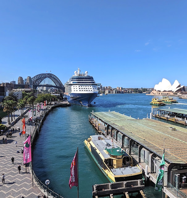
Today, you can take a ferry from Circular Quay.
Circular Quay, Sydney, NSW, 1867,.A seagoing barque is working cargo with the aid of a small steam crane. The Customs House at left is yet to be given extra construction and the Paragon Hotel is ready for business. Royal Standard flys above triumphal arch for the visit of Prince Alfred, Duke of Edinburgh. City of Sydney Archives.
Emu (II) at Circular Quay, Sydney, NSW, 1886 - image from the collection of the Australian National Maritime Museum on The Commons
Circular Quay, Sydney , NSW, 1920s
Circular Quay, Sydney, NSW, 1938, The Home : an Australian quarterly.
Circular Quay, Sydney, NSW

2. Cadman's Cottage

Cadman's Cottage, a two-storey white sandstone house, was built in 1816 for the governmental coxswains and their crews. Later, the building became a water police station and sailor's home. Located on the original shoreline of Semi-Circular Quay. (Due to the reclamation of land during the building of Circular Quay, the waterline is now about 100 metres away)
Looking across Circular Quay in 1874, from Bennelong Point, Sydney, taking in the former Tarpeian Way Quarry. Much of the stone from here was used to build early Sydney structures of which only the Man O' War Steps remain. NLAUST
Cadman's Cottage, Circular Quay, Sydney, NSW,a two-storey white sandstone house, was built in 1816 for the governmental coxswains and their crews

3.  Customs House 

Customs House, at 45 Alfred Street, Sydney CBD, was built on the southern shore in 1844–1845 during the construction of Circular Quay.
Horsebus outside Customs House at Circular Quay, Sydney, NSW, in 1900. NAAUST
Customs House at Circular Quay, Sydney, NSW, in 1903. Source: State Archives.
Circular Quay, Sydney, NSW, in the early 1900s. In the foreground is the Australasian Steam Navigation Company building, constructed in 1883, a rare example of Anglo Dutch style. On the left behind the wharves stands the Farmers and Graziers wool store originally built by Mort and Co in the 1860s and on the right is Customs House showing the additions made in the early 1900's by New South Wales Colonial Architect, Walter Liberty Vernon. Many steam ships can be seen berthed along both sides of the quay and steam ferries are plying the harbour in the centre of the scene. Powerhouse
x
Customs House, Sydney, NSW

4. Gannon House

Gannon House at 45–47 Argyle Street, The Rocks, Sydney CBD, was designed by Michael Gannon and built from 1839 to 1840. (Colonial Georgian architecture)

5. The Rocks Discovery Museum 

The Rocks Discovery Museum is free to visit, with disabled access. Located in a restored 1850s sandstone warehouse in Kendall Lane, in The Rocks, Sydney.

The museum is interactive, with touch screens, audio, film and artefacts, telling the story of the area, from Aboriginal traditional life to British arrival and settlement.
The Rocks Discovery Museum is free to visit, with disabled access. Located in a restored 1850s sandstone warehouse in Kendall Lane, in The Rocks, Sydney.

6. Some Historic Hotels

39–43 Argyle Street: British Seamen's Hotel

100–104 Cumberland Street: Australian Hotel

69 George Street: Observer Hotel

137 George Street: Fortune of War Hotel
The Fortune of War, The Rocks, Sydney, NSW, was originally built in 1828 by former convict Samuel Terry
143–143a George Street: Russell Hotel

153–155 George Street: New York Hotel

7. Unwin's Stores
 
Constructed between 1843-46, Unwin's Stores at 81-85 George Street, The Rocks, Sydney, stands where Sydney's first hospital and gardens existed. They are five sandstone buildings, originally built as shops and dwellings in Colonial Georgian style. Now contain shops and cafes.
Constructed between 1843-46, Unwin's Stores at 81-85 George Street, The Rocks, Sydney

8. The Argyle Stores

The first building on the site was the house of Captain John Piper, commenced constricution in 1826. This became the east wing of the current Argyle Stores.

The site was also part of a former custom house and bond store, now offices, bar, function rooms and restaurant, located at 12–20 Argyle Street, The Rocks.
Argyle Stores, Argyle Street, The Rocks.

9. Old Metcalfe Bond; Campbells Store

Old Metcalfe Bond; Campbells Store was built as store houses and maritime bonded warehouses from 1850 to 1861. It faces Campbells Cove, an inlet in the north-west of Sydney Cove. (7 – 27 Circular Quay West, The Rocks). Mostly, restaurants.
Old Metcalfe Bond; Campbells Store was built as store houses and maritime bonded warehouses from 1850 to 1861, The Rocks, Sydney, NSW

10. Foundation Park

Foundation Park is hidden behind a row of shops on Playfair Street at The Rocks. The site is made up of what were formerly No's 2-16 Gloucester Street, eight terrace houses constructed in the mid-1870s that were demolished in 1938.
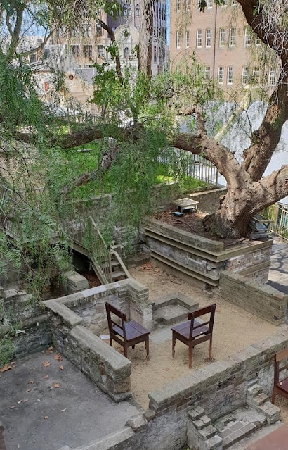
Visitors can walk through the ruins of eight houses that were built into the sandstone cliff face from 1874 to 1878.

The Rocks was so densely populated in the 19th century that every spare area of land was used for housing. The rooms in the eight terrace houses were no larger than 3m x 3m and demonstrate the cramped living conditions at that time.
Foundation Park, The Rocks, NSW is woven among the foundations of eight 1870s terrace houses behind the Playfair Terrace shops.


More Information

The Sydney Writers Walk; metal plaques embedded along the walkway around Sydney's Circular Quay.

The Rocks Walking Tour (Self Guided), Sydney